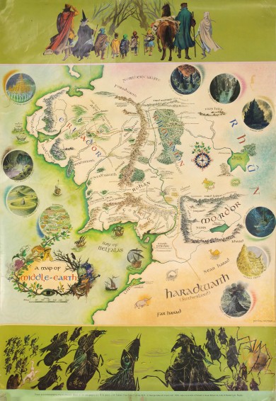
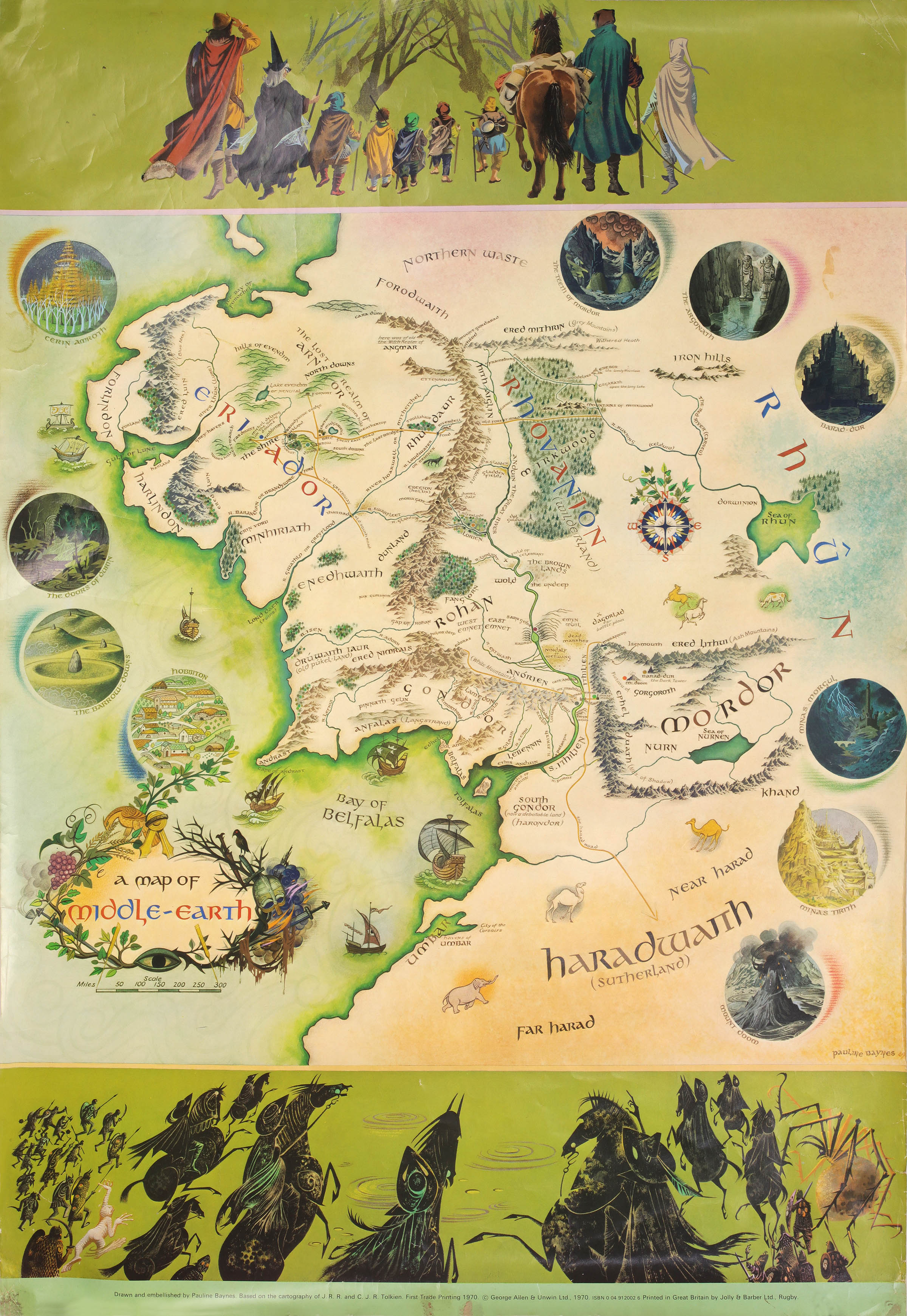
A Map of Middle-Earth
Drawn and embellished by Pauline Baynes. Based on the cartography of J.R.R. and C.J.R. Tolkien.
George Allen & Unwin, 1970.
First edition, trade printing. 730 x 510mm. Illustrated map of Middle Earth in colour, with illustrated borders and ten vignettes of Middle Earth around the map. A near fine example with a small abrasion to the base of the map, but notably free from fading to which this map is prone.
This iconic map of Middle Earth was produced by Pauline Baynes in conjunction with J.R.R. Tolkien, who sent her an annotated copy of his son Christopher's map of Middle Earth (now in the Bodleian Library) to use as a basis for her version.
According to an Allen & Unwin memo cited by Hammond, "50 copies were to be printed on cartridge paper with a 'privately printed' label, followed by 7,500 copies on Cartridge as the normal trade edition, followed by an unspecified quantity on glossy stock."
The 'private' copies were for the publisher's internal use only. This copy, on 'cartridge' paper, is identical to the private printing in every way except being described as 'First Trade Printing'. Specifically, it mentions the printers, Jolly & Barber Ltd., Rugby, a detail which is omitted from some (possibly much) later printings which carry a deeper border at the base of the map.
It is unclear at this stage whether the purpose of the maps in this printing was commercial or purely promotional. Whatever the reason, copies are now seldom seen, particularly in nice condition.
Hammond Eii4.
Stock ID: 45098
Sold
We have sold this item, but similar items
may become available in the future
